
.png)
Design of Green City with Lower Carbon based on Vegetation in Banjarbaru using Sentinel-2
Abstract
In addressing the pervasive issue of Urban Heat Islands (UHI) and the related carbon sequestration challenges in urban settings, this study utilizes Sentinel-2 imagery to propose a vegetative blueprint for the design green city with lower carbon in Banjarbaru. This research intricately links the role of increased vegetation cover in mitigating UHI effects and enhancing carbon absorption in urban environments. By employing a combination of Geographic Information Systems (GIS), field data, and real-time data via Wireless Sensor Networks (WSN), the study highlights the significant cooling and environmental benefits of strategically increasing green spaces in urban areas. Moreover, the study identifies specific zones within Banjarbaru that are optimal for the strategic placement of vegetation to maximize thermal comfort and carbon storage. This focus on localized green infrastructure development not only provides a pathway to more sustainable urban living conditions but also serves as a model for other cities facing similar ecological and climatic challenges. The integrated approach adopted here emphasizes continuous monitoring and dynamic adjustments in urban planning, ensuring long-term sustainability and resilience against the ongoing threats posed by climate change and urban expansion.
Article Metrics
Abstract: 615 Viewers PDF: 448 ViewersKeywords
Full Text:
PDFRefbacks
- There are currently no refbacks.

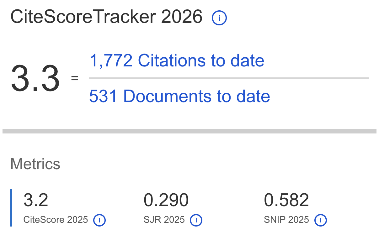
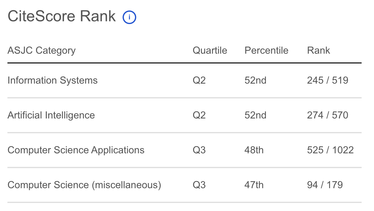
Journal of Applied Data Sciences
| ISSN | : | 2723-6471 (Online) |
| Publisher | : | Bright Publisher |
| Website | : | http://bright-journal.org/JADS |
| : | taqwa@amikompurwokerto.ac.id (principal contact) | |
| support@bright-journal.org (technical issues) |
 This work is licensed under a Creative Commons Attribution-ShareAlike 4.0